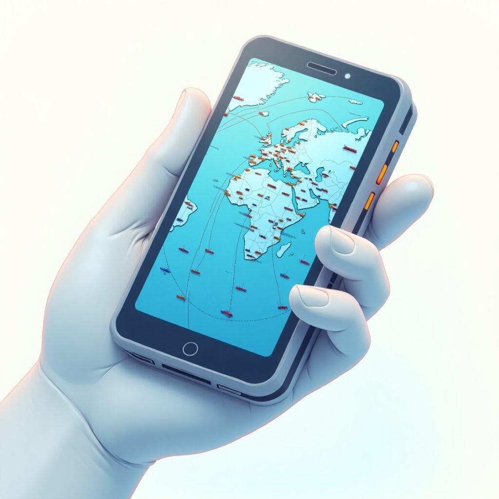
When you think of global ship tracking, you might imagine satellite control centers, radar towers, and massive control rooms filled with blinking monitors. But what if all that power and precision could be condensed into a single app on your smartphone? Welcome to the world of MarineTraffic, the most widely used vessel tracking app on Earth. From shipping companies to port authorities, sailors to enthusiasts, this application has changed how we view maritime activity in real time.
MarineTraffic offers something unprecedented: the ability to monitor the positions, identities, and movements of over 200,000 vessels worldwide using Automatic Identification System (AIS) data. With intuitive interfaces and a powerful data engine, MarineTraffic has made maritime monitoring accessible to anyone with a phone or tablet.
How MarineTraffic Works: AIS and Real-Time Data Power
At the core of MarineTraffic lies the Automatic Identification System (AIS) — a global standard for tracking maritime traffic. All commercial vessels over 300 gross tonnage are required by international law to transmit AIS signals. These signals include GPS position, vessel name, speed, destination, and more.
MarineTraffic gathers AIS data from:
- A vast network of over 18,000 land-based AIS receivers
- Satellite AIS receivers for remote ocean coverage
- Voluntary data contributions from vessels and operators
All this data is aggregated and visualized through the MarineTraffic app, allowing users to:
- Track ships in real time anywhere in the world
- View port congestion and arrivals
- Follow specific vessels or types of ships
User Interface and Features: Designed for All Audiences
Whether you’re a casual maritime enthusiast or a seasoned fleet manager, MarineTraffic offers a range of features for every level of interest and expertise. The interface is user-friendly, with customizable maps and detailed ship profiles.
Key features include:
- Live Map: Interactive map displaying all vessels globally
- Port Traffic Analysis: See arrivals, departures, and congestion
- Ship Search: Lookup by name, IMO number, or MMSI
- Fleet Management Tools: Ideal for companies managing multiple ships
- Notifications: Alerts for vessel arrival, departure, or movement
MarineTraffic also supports layers for weather data, wind direction, and sea state, enabling a more dynamic and context-rich maritime experience.
Applications in the Maritime Industry and Beyond
MarineTraffic is not just an app for hobbyists. It is also a vital tool used across multiple sectors:
- Logistics Companies: To optimize cargo routing and delivery times
- Port Authorities: To manage berth scheduling and customs coordination
- Environmental Agencies: To monitor shipping emissions and traffic in sensitive marine zones
- Naval and Coast Guard Operations: To ensure safe navigation and national security
“Access to real-time AIS data transforms operational planning. We now react faster and plan better,” says Laura Middleton, logistics manager at BlueWave Shipping Group (Middleton, 2023, BlueWave Maritime Journal).
Why MarineTraffic Is a Game Changer for Maritime Safety
Safety at sea has always been a complex issue. MarineTraffic contributes significantly by offering:
- Collision avoidance tools
- Real-time tracking for distress or missing vessels
- Pirate activity monitoring in high-risk areas
- Compliance with IMO regulations
According to Dr. Thomas Li, professor of Maritime Security at Global Ocean University, “MarineTraffic democratizes maritime safety by offering tools previously limited to national navies or corporate fleets” (Li, 2024, International Journal of Marine Safety).
Mobile and Desktop Access: Flexibility at Sea and On Land
MarineTraffic is accessible via multiple platforms:
| Platform | Access Mode | Key Features |
|---|---|---|
| iOS/Android | Mobile App | GPS tracking, push alerts, fleet view |
| Web Browser | Desktop Access | Port reports, analytics, historical playback |
| API Access | Custom Integration | Used by developers, shipping software, and logistics systems |
You can use the same login across platforms, ensuring synchronization between mobile and desktop sessions. Offline access to maps is also available in premium plans.
Types of Vessels You Can Track with MarineTraffic
MarineTraffic categorizes vessels into several types, helping users filter by interest or need:
| Vessel Type | Example Uses |
|---|---|
| Cargo Ships | Global freight transport |
| Tankers | Oil, gas, and chemical delivery |
| Passenger Ships | Ferries, cruise ships |
| Yachts & Leisure Boats | Private marine traffic |
| Fishing Boats | Commercial and local fishing fleets |
| Tugs and Pilots | Port operations and ship guidance |
The app allows you to filter, follow, and receive notifications for any type you choose.
MarineTraffic for Enthusiasts: A Hobby with Global Reach
Beyond professionals, MarineTraffic has become a global phenomenon among:
- Shipspotters
- Port photography enthusiasts
- Cruise fans tracking their favorite liners
- Educators teaching geography and maritime history
With the ability to “replay” past voyages and observe global shipping routes, the app becomes not just a tool but a platform for discovery and storytelling.
Bullet Points: Benefits for Hobbyists
- Free access to live data
- Educational use in classrooms
- Historical data for research
- Community-uploaded ship photos
- Geographic awareness through real-time tracking
Subscription Plans: From Free to Enterprise Level
MarineTraffic offers several tiers of service:
- Free Plan: Live map, limited access to ship data
- Basic Plan: More ship details, port data
- Professional Plan: Historical tracking, weather layers
- Enterprise Solutions: For shipping companies and logistics networks
Pricing is based on the number of features and level of data access, and it’s scalable depending on the user’s needs.
Integrations and API: Building the Future of Maritime Tech
MarineTraffic’s API is used by developers and industry professionals for:
- Custom dashboards for shipping companies
- Integrating ship positions into port management software
- Real-time fleet visibility in cargo logistics platforms
It supports RESTful API calls and returns data in JSON or XML formats, making it versatile for various software environments.
Global Impact: MarineTraffic and Sustainability
With real-time tracking of CO₂ emissions and fuel consumption per vessel, MarineTraffic is increasingly used by environmental researchers and NGOs. Its emissions monitoring dashboard helps companies and regulators ensure compliance with:
- IMO 2020 Sulphur Cap
- EU Emissions Trading System (ETS)
- UN Sustainable Development Goals (SDGs)
By giving visibility into high-traffic shipping zones, the app supports better decisions about marine conservation and pollution control.
Conclusion: Why MarineTraffic Belongs on Every Maritime Professional’s Device
In the past, maritime tracking was a luxury available only to national fleets, military intelligence, or port authorities. MarineTraffic has flipped the script, putting global maritime intelligence into everyone’s hands, whether you’re a ship captain, port manager, or just someone curious about the ship passing by your coastal town.
From real-time AIS tracking to port logistics, historical voyages to environmental data — MarineTraffic delivers it all with remarkable ease and precision.
References
LI, Thomas. MarineTraffic democratizes maritime safety by offering tools previously limited to national navies or corporate fleets. International Journal of Marine Safety, 2024. Disponível em: https://ijms.org/marinetraffic-safety
MIDDLETON, Laura. Access to real-time AIS data transforms operational planning. BlueWave Maritime Journal, 2023. Disponível em: https://bluewavemaritime.com/journal/ais-impact
NAVIONICS. Marine Navigation Apps Compared: Navionics vs MarineTraffic. Navionics Official Website. Disponível em: https://www.navionics.com/blog
MARINETRAFFIC. Official MarineTraffic Features and Plans. MarineTraffic.com. Disponível em: https://www.marinetraffic.com
IMO. AIS Standards and Regulations. International Maritime Organization. Disponível em: https://www.imo.org/en/OurWork/Safety/Pages/AIS.aspx

